Automatic Password Password Changing Explanation
We reserve the right to automatically change a password which the ARCHI password verification system has identified as having an unusual pattern of activity, for example being used from different IP addresses at similar times.
We are aware that this may have raised alarm bells in some people, who may have been inadvertently picked up by the system.
If you are the person who set up an ARCHI subscription, there are a number of reasons why this password might have been picked up by the system. Your internet service provider (ISP) may use a dynamic IP allocation system, which triggers our alert for multiple usage. Or, if you are very mobile when you use ARCHI then the system may pick this up. This is absolutely not a problem and we encourage you to use ARCHI as much as you can to help with your research.
However, we need to protect the system from gross password sharing, which has been on the increase within the ARCHI community for a number of years now. Password sharing has a major impact on the load on the ARCHI website architecture, leading to reduced performance, reduced speed and website crashes. This isn't fair on the users who have taken out a paid subscription. Sharing with your close friend or family member is understandable but those who have been sharing with people further outside that circle has lead to an unintended explosion in over-use. Continued over-use will force us to raise the subscription prices in order to cover the costs associated with supporting these additional users who are not contributing. We feel obliged to address this now on behalf our valued paying members.
Hence, we hope you are happy that we take measures to address the problem of wide-scale password sharing with ARCHI.
Copyright Statement for ARCHI MAPS
Copyright © 2024 ARCHI MAPS UK. All rights reserved.
The ARCHI MAPS UK database and all associated content have been developed and curated by ARCHI UK over the past 20 years. The database includes information on archaeological sites, historical locations, and coordinates that have been gathered, compiled, and organized through extensive research, data analysis, and contributions from a variety of public-domain and independently sourced materials.
Copyright, Database Rights, and Map Layer Integration
ARCHI MAPS UK asserts copyright and/or database rights on all unique aspects of the database, including the compilation, organization, and presentation of data. All coordinates, site names, and historical information within the database are selected and organized with care and expertise to create a valuable resource for educational, research, and informational purposes. The database presents cultural, historical and archaeological site data points on various interactive map layers, which have been developed to provide enhanced spatial understanding and user interactivity. Integrating these data points with diverse map layers represents a new creative work that combines technical expertise with an original, user-focused design.
The visualization of data across multiple layers—including topographical, satellite, historical, and other thematic maps—constitutes an original, creative product. This presentation enhances the interpretive value of the data, transforming it into a uniquely accessible resource for educational, historical, and research purposes.
Use of Data and Licensing
The use of data contained within the ARCHI MAPS UK website is restricted to personal, educational, and non-commercial use unless explicitly authorized by ARCHI UK. Commercial use, reproduction, or redistribution of data from the ARCHI MAPS UK website, in part or in whole, is prohibited without prior written consent. Unauthorized extraction and/or reuse of substantial parts of the database may constitute a breach of copyright and/or database rights and will be pursued under applicable UK and international copyright law.
Fair Use and Exemptions
In line with copyright law, ARCHI MAPS UK permits fair use of data for academic research, private study, and educational purposes. Users are encouraged to cite ARCHI MAPS UK as a source in any non-commercial research or publications where data from the database is referenced.
Credits and Acknowledgments
ARCHI MAPS UK acknowledges the value of collaboration with academic institutions, historical societies, and contributors who have shared knowledge and information that has been used to enrich the database. Any use of third-party content is fully credited, and all materials from public domain sources are utilized in compliance with copyright law.
Disclaimer of Liability
While ARCHI MAPS UK endeavors to maintain accurate and up-to-date information, the database is provided "as is." ARCHI MAPS UK accepts no responsibility or liability for errors, omissions, or inaccuracies in the database or for any use of the data contained within it. Users are encouraged to verify information independently before relying on it.
Fair Use Policy
ARCHI Services
Please ensure you have read and understood our Fair Use Policy, which forms part of the Prepay Terms and Conditions, Pay Monthly Terms and Conditions and Business Terms and Conditions (as applicable).
- All of the Services are subject to the Fair Use Policy.
- Your use of the Services must be fair, reasonable and not excessive, as reasonably determined by us by reference to average and/or estimated typical customer usage of the Services. We will consider your usage to be excessive and unreasonable where it materially exceeds the average and/or estimated use patterns over any day, week or month (or other period of time as determined by us) (Excessive Usage).
- Where we offer any included Services under a Plan or other Service, such use is offered for your individual private and personal use and benefit only. In no case does any Service allow for activities aimed at making profit or reselling the Service or using the Service in an unfair or excessive way and any such use of the Services by you is a breach of this Agreement.
- If in our reasonable opinion we consider your usage to be unfair, unreasonable and/or Excessive Usage we may immediately suspend, modify or restrict your use of the Services or withdraw in full or in part your access to the Services without notice to you.
All content on this website, including but not limited to text, graphics, images, and code, is the property of ARCHI Information Systems Ltd and is protected by United Kindgom and international copyright laws.
Screenshot Re-use for Non-profits
We hereby grant permission for the use of screenshots from our website for non-profit community projects or for educational establishments, provided that the purpose of such use is not for commercial gain, and that appropriate attribution is given to the ARCHI UK Website (https://www.archiuk.com) (ARCHI Information Systems Ltd). However, we would appreciate it if you could send us ARCH UK: Screenshot Reuse Notice how you will / have used the screenshots plus, if possible, a link to any online or print publications the images appear in.
Any other reproduction, distribution, or use of materials from this website without the express written consent of ARCHI Information Systems Ltd is strictly prohibited.
If you wish to use any content from this website for commercial purposes or for any other use not expressly permitted by this statement, please contact ARCHI Information Systems Ltd to obtain permission.
Thank you for respecting our intellectual property rights.
Map Attribution
ARCHI uses data from various providers. You are welcome to make fair use of screenshots of the maps generated on the ARCHI website for purposes such as news and magazine articles, TV programmes, corporate presentations, survey reports etc., in either electronic or print format, as long as any image is accompanied by a mention of the ARCHI website, its web address (https://www.archiuk.com) and the attribution statement of the provider(s) whose data appears in the screenshot.
Map Attribution Example
Something on the lines of:
[map series eg LiDAR] Screenshot from the ARCHI MAPS UK website at https://www.archiuk.com; LiDAR tiles © Environment Agency copyright and/or database right 2022. All rights reserved.
OS 1st Edition 1-inch: OS 1 inch 1st Edition imagery, tiled and served by ARCHI Information Systems Ltd via ARCHI MAPS ([www.archiuk.com](http://www.archiuk.com)). Original mapping © Crown copyright (Ordnance Survey), reproduced from historical sources.
Old Maps: © ARCHI Information Systems Ltd 2023. All rights reserved / © National Library of Scotland
LiDAR: © Environment Agency copyright and/or database right 2022. All rights reserved.
Basemaps: © Google / Openstreetmap
would be acceptable together with an attribution statement for the particular provider.
It would be appreciated if you could also let us know when you have made such use of the data and mapping resources presented on our website as we do have more maps in our archive which are not yet on the website. So, we may additional maps of your research area but not yet on the ARCHI MAPS UK website.
First Edition Ordnance Survey 1 inch to 1 mile map layer (1805-1845)
Regarding our 1st edition OS 1 inch map layer (1805-1845), you are again welcome to take screenshots of the membership-free lower resolution imagery currently available on the website. Full high-resolution versions of 1km square sections of this paricular map layer are available upon request.
Contacting Us
ARCHI is an web-based only service. If you wish to contact us, please click one of the following options and send a message with details of your query. Please bear in mind we are a small business with limited resources but we still aim to respond to your query within 3 working days. However, in practice our response time is usually much sooner.
These maps freely available on the ARCHI website and don't require a subscription to access them.
For more information on taking out an ARCHI MAPS UK Subscription, please go to our ARCHI MAPS UK Subscription information page.
If you have any other queries relating to this particular series of maps, please email us using the link here Ordering 1" First Series Prints / Digital Images of Old Maps on the ARCHI website
Our license doesn't allow us to sell digital images, offer download facilities or prints of this series of old maps. You can buy them from the National Library of Scotland though.
To do this just do the follow these steps:
- Go to the ARCHI MAPS UK home page.
- In the Search Form enter the name of the location you are interested in. There is no need to enter a password.
- At the top of the ARCHI search results you will see the icons linking to the different map series available on the website.
- For the OS 6" First Edition Series, click the corresponding icon ie the one to the right of the entry for 'Early 6 inch Old Historical Map (1888-1913)'
- On the resulting page you will see the sentence:
- Maps generated from ARCHI UK Search and this map can be purchased from the National Library of Scotland's Mapping Service.
- Click the link to the 'National Library of Scotland's Mapping Service'.
- When you see the map on the NLS website, click the 'View this Map' link.
- When you see the map you wish to purchase (either print or digital), click the 'Order this Map' button.
If you have any other queries relating to this particular series of maps, please email us using the link here Ordering 6" First Series Prints / Digital Images of Old Maps on the ARCHI website
Logging into the ARCHI System
There is no formal login procedure with the ARCHI service. Instead, once you have set your password, just enter it into the 'password' field on the various ARCHI Search forms on the ARCHI website.
This is to make is easier to comply with future data protection legislation. This actually makes things quicker and easier for you and helps to protect your rights to privacy on the internet.
Fair Use Policy
We run a fair use policy and ask you to not share passwords please. 'Fair Use' of the ARCHI system is 300 searches per individual subscription from a maximum of 15 different IP addresses. These figures are based on tripling the historically average number of annual searches per user (100) from an average of five different IP addresses per user.
The ARCHI System is able to detect potential abuse and scraping attempts. We reserve the right to block access to the ARCHI databases if potential abuse is identified.
However, it is recognised that some users will go over the Fair Use Quota.
As we do not have access to your PayPal account, please follow the instructions below to cancel your ARCHI subscription.
- Log in to your PayPal account at PayPal
- Click Settings near the top of the page
- Depending upon your version of PayPal, either click Payments or select Pre-approved Payments which is under Payment settings
- Click Manage pre-approved payments
- Select the merchant whose agreement you want to cancel
- Click Cancel or Cancel automatic billing and follow the instructions
- Confirm your request to finalise the cancellation
If you are still unable to cancel your ARCHI subscription please email us using the link below. Don't forget to let us know the name used to set up the account and postcode if possible. This will help us locate your account Please Cancel My ARCHI Subscription
ARCHI UK License Agreement
License: Personal, non-commercial or educational use for a single user only. Block subscriptions can be purchased for Schools, Colleges and Higher Education Academic institutions and the subscription rate depends upon the number of users. See below for more information on multiple user subscriptions.
Please contact us via e-mail at enq@archiuk.com if you wish to purchase a block subscription.
Payment by Mail Order
We do accept cheques or postal order for £50 + VAT and made payable to "ARCHI Information Systems Ltd". Email us for more details.
ARCHI User Question: Which maps show individual farms and landowners?
Locating Farms on old Maps
Tithe Maps
For the most detailed information available from the 1840s, you may wish to view the Parish Tithe Maps and their accompanying Apportionments. These records list individual landowners, occupiers, and field boundaries, making them the most precise source for identifying specific farms and holdings around the 1841 census period. Unfortunatley, we don't have these maps but we may be able to source this on your behalf, usually via a third-party researcher, at a typical cost of around £30–£50.
However, most of the the Cornish tithe maps are available via the Cornwall Historic Environment interactive map at:
https://map.cornwall.gov.uk/website/ccmap/?zoomlevel=1&xcoord=162690&ycoord=64380&wsName=CIOS_historic_environment. However, I think (but not sure) that you have to pay for the full maps and apportionments if you want a digital copy.
ARCHI MAPS: Choosing the Right Map for Your Research
ARCHI UK offers a range of historic Ordnance Survey maps to help you explore how your area evolved through time.
- 1-inch First Edition (c.1840s) - Free Access: : Reduced resolution but ideal for setting the historical scene around the time of the 1841 census. These maps give a broad overview of farms, roads, and settlements during the early Victorian period.
- 6-inch to the mile First Edition (c.1880–1903) – Subscriber Access: These beautifully detailed maps show individual field boundaries, farm buildings, mine workings, and even small hamlets. Perfect for serious research into how the rural landscape developed after the mid-19th century.
- 6-inch to the mile Second Edition (c.1903–1930) – Free Access: Lower resolution but excellent for general orientation and studying early 20th-century changes in farming, mining, and settlement patterns.
Together, these maps offer an exceptional window into the changing Cornish landscape—from the first national surveys of the 1840s to the industrial and agricultural transformations of the early 1900s.
Ordnance Survey 1 inch per mile 1st Edition - 1805-1845 (Free Access)
You may find the ARCHI UK Ordnance Survey 1-inch First Edition maps particularly helpful for your research. These mid-19th-century maps—available to view directly through the ARCHI map viewer—offer a clear picture of a parish's landscape around the 1840s, close to the 1841 census period.
Although they don’t show individual ownership, they do identify many named farms, hamlets, and key landscape features, helping to place your ancestors or localities within their historical setting. They’re an excellent starting point before moving on to the more detailed tithe or estate maps that show ownership and field boundaries.
If you're looking for the name of a particular farm on old maps, then a search of the ARCHI MAPS database (www.archiuk.com) for the parish / place where the farm was / still is, is where to start. The earliest maps we currently have are the OS 1" 1st Edition.
These are available free of charge and a donation is always welcome as this helps us keep them free for other people.
The higher resolution versions are scheduled to be released to the website by the end of 2025 but these will require an ARCHI subscription to view. However, most people find the free versions are good enough for their research purposes.
Ordnance Survey 6 inch per mile 1st Edition (circa 1880-1903) (Subscriber Access)
For even greater detail, our Ordnance Survey 6-inch to the mile First Edition maps (c.1880–1903) are available to ARCHI subscribers. These beautifully engraved maps are among the most detailed ever produced before the modern era, showing individual field boundaries, farm buildings, mine workings, tramways, quarries, and even smaller hamlets that don’t appear on earlier editions. They’re invaluable for tracing how farms, roads, and settlements developed after the mid-19th century, and for pinpointing precise locations mentioned in tithe maps or early census records. If you’re serious about understanding the historical landscape of the places / parishes you might be interested in, these maps are one of the most rewarding resources available through ARCHI.
Ordnance Survey 6 inch per mile 2nd Edition (1903-1930) (Free Access)
You can also explore our Ordnance Survey 6-inch to the mile Second Edition maps (c.1903–1930), which are freely available to view without a subscription (a donation is always welcome :-)). These provide excellent coverage of Cornwall during the early 20th century and are ideal for general orientation or studying broad landscape changes since Victorian times. Although they are lower resolution than the subscriber maps, they still reveal a great deal of topographical detail—showing villages, farms, and features such as quarries, tramways, and mine workings. They’re perfect for getting a sense of the area’s layout before diving into the higher-detail First Edition maps available to ARCHI members.
These are available free of charge but a donation is always welcome as this helps us keep them free for other people. However, the resolution is quite low on these and there aren't any plans to increase the resolution as it would be financially unviable to do so at the current ARCHI MAPS subscription rate.
Tithe Maps and Associated Apportionment Lists
For the most detailed information available from the 1840s, you may wish to view the Parish Tithe Maps and their accompanying Apportionments. They may be available online via These records list individual landowners, occupiers, and field boundaries, making them the most precise source for identifying specific farms and holdings around the 1841 census period. Unfortunatley, we don't have these maps but we may be able to source this on your behalf, usually via a third-party researcher, at a typical cost of around £30–£50.
Technical Considerations
How accurate are the locations / co-ordinates of the archaeological / historic sites listed in the ARCHI UK datbase?
More than 85% of the sites listed in the ARCHI UK database are accurate to 6 or more figures in the UK National Grid Referencing System (eg TL 065 0227). This is the accepted accuracy for archaeological reporting with respect to the publications (eg journals, books and archaeological reports) the data has been sourced from. A 6 figure co-ordinate means that the site/find will be within the 100 metre square referenced by the co-ordinate.
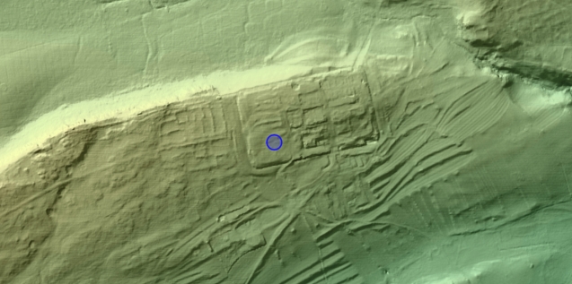
As an example, consider the Priory site at TL 065 0227. On the map the marker is right on the site. However, be aware that if for example a coin is geo-referenced to 6 figures, then the coin would have been found in the 100 metre square indicated by the co-ordinate of the find.
What does it mean when a map marker pop-up says that the marker is a four figure NGR (National Grid Reference)?
A four figure grid reference (eg TQ 12 34) means that that the actual archaeological site or findspot is within 1km of the place marked on the map. The reason for this lower than normal site/find-spot accuracy is because the data relating to the site is likely to have been published in a very old report, when it was only thought to be necessary to record sites and find-spots to the parish level.
Hence, when a site record or map marker pop-up states that the source data was a 4 figure co-ordinate please be aware that the markers just marks the centre of a 1km square and the site or find is within that 1km square and not that exact point in a field.
Going further into the old practice of recording sites/finds to the nearest parish or place-name associated with a find / site's co-ordinate, this is actually an extrapolation from the place's co-ordinate which is cross-referenced with the ARCHI database of place-names. Hence, in some cases a site may actually be in a particular parish but because the centre of a neighbouring parish is closer, the site is 'tagged' with this place-name. Again this is because many of the sites and findspots were just recorded as co-ordinates in the original publication and the place-name has had to be calculated in order to give some measure of locational context.
How Can I Narrow A Search Down to a Smaller Area (eg 5km or 3km)
You can use the ARCHI Advanced Search to narrow down your search area. You can access the Advanced Search by clicking the link to it at the top of the Quick Search form on the ARCHI home page
.
On the Maps of Archaeological Sites, is the resolution of the marker positions based on the grid locations (typ +/-50m) or the lat/long (more decimal places)?
All the locations in the ARCHI UK database are held in the British National Grid Format. At least 85% are to 3 figures or more (many to 4 or 5 figures). Regarding the decimal lat/longs, these are all extrapolations from the NGRs with the heart of the code referencing methods associated with the Herlmert transformations ie they are of the same accuracy as the National Grid References they were extrapolated from.
Also, there is the problem of extrapolation from NGR to decimal lat/long and the inherent inadequacies associated with the translation. All the data in ARCHI is held as NGRs but plotting on the the maps requires translation to decimal lat / long.
Regarding the place-name associated with a find / site's co-ordinate, this is actually an extrapolation from the co-ordinate which is cross-referenced with my database of place-names. Hence, in some cases a site may actually be in a particular parish but because the centre of a neighbouring parish is closer, the site is 'tagged' with this place-name. Again this is because many of the sites and findspots were just recorded as co-ordinates in the original publication and the place-name has had to be calculated in order to give some measure of locational context.
Understanding Map Displays and Location Matching
Why am I seeing maps that don’t match my selected area?
Ordnance Survey 6 inch to 1 mile 2nd Edition (circa 1903-1930)
The OS 6" 2nd Edition maps are delivered by a different system to the OS 1" 1st edition and the OS 6" 1st edition. The whole sheet is delivered by sheet number via a clickable thumbnail that links to a larger version. If you see a thumbnail, there is a full version available. Occasionally, however, there may be discrepancies in file naming that prevent the correct map from loading. If you do experience this, please let us know by clicking this link and sending a message: ARCH MAPS UK: Missing Map. We will endeavor to fix the problem as soon as we can.
Additionally, mismatches in map locations may result from the interpolation process used to align each map sheet's coordinate system. This is an imperfect system and can be especially tricky in areas like Yorkshire, where the map series doesn’t align smoothly with the post-1971 county boundary changes. We appreciate your understanding!
Ordnance Survey 1 inch to a 1 mile 1st Edition (circa 1805-1869) ie Georgian & Victorian Ordnance Survey Old Series / First Series Maps of the British Isles
The "Old series" map was first published in 1805, covering England and Wales in its entirety by 1869 (though a 'New Series' had already been authorised and began in 1863). It used a variation on the Cassini Projection using Delamere as its origin - this may cause distortion in some areas as we have attempted to reproject the map onto the more modern Web Mercator projection to work on modern web viewers. As a result it is only possible to give an approximate modern geographic reference of areas on this map, with geolocation most accurate near the coasts and least accurate towards the centre of the country.
Data Sources
The data within ARCHI UK has been sourced from a wide range of publications ranging from specialist books dating back to the 19th century, to the "mainstream" archaeological journals such as Britannia, Council for British Archaeology Reports etc. Additionally, data has been sourced from archaeological surveys published by various Local Historical / Archaeological Societies and Field Groups.
Click for a list of all the archaeological journals from which the ARCHI database is sourced.
ARCHI UK utilizes publicly available datasets and information derived from a variety of recognized sources that operate under the Open Government Licence (OGL). This includes data on archaeological sites and heritage information that is freely accessible to the public, ensuring compliance with transparency and open data principles. It is important to note that, although the Portable Antiquities Scheme (PAS) operates under the OGL, ARCHI UK’s policy has never been to use the PAS database.
Data Independence from PAS: Statement of Policy and Transparency
The data in the ARCHI UK database is entirely distinct from that of the Portable Antiquities Scheme (PAS) database. ARCHI UK only draws from publicly accessible publications, ensuring that no unpublished or sensitive PAS data is included in our database. Our database is compiled from a variety of publicly available sources, including archaeological reports, academic books, journals, and contributions from historical enthusiasts and professionals over the past 20 years. This ensures that all grid references and site information are sourced from materials already in the public domain, and none of the data originates from the PAS.
How do I Find the Bibliographic Source / Reference of the Information for a Particular Archaeological / Historical Site
The bibliographic sources for each of the sites and monuments listed in the ARCHI database used to be included in the sites lists but these were taken out a few years ago because we had a number of complaints with respect to the amount of viewable data on a screen on mobile devices. However, we have revoked that decision because many people have asked for them to be re-instated. Hence, we are now in the process of re-instating them but this takes time because the ARCHI data needs to be reconfigured and code re-written. As regards finding more about these sites, once the bibliographic sources have been merged with the sites data, the entries in the site lists will contain references to where the GPS location of the sites originated from plus where to find more information about these sites.
If I make a donation, can I access the ARCHI archaeological site GPS locations databases
The donation buttons are generally used by people who would like to make a contribution towards the costs of providing the free services on the ARCHI website. These free services are access to the British Ordnance Survey old maps, Antique Old Maps, ARCHI UK Place-Name Finder, ARCHI Wordwide Archaeological and Historical data and maps and other free archaeological and historical research services on the ARCHI website. You do not have to make a donation to access these services but it is very much appreciated if you do as there are significant costs to cover for us to provide these free services.
Access to the UK archaeological sites GPS locations and maps does require the purchase of a subscription to the ARCHI UK database, which is currently £50 + VAT per year.
Click here to return to ARCHI UK's search page.
Individual Subscription Pricing
For individuals, the cost of a year's subscription to the ARCHI UK database of UK Archaeological Sites is £50 + VAT
Educational Institution Subscription Pricing
Multiple access to ARCHI UK is open academic institutions and the yearly subscription rate depends on the size of the faculty and the projected number of users.
Academic (University) online subscriptions start at £225 + VAT per annum.
School online subscriptions start at £50 + VAT per annum.
Institutions have the choice of accessing the data via a password or automatically through the institution's IP address(es).
If you would like your group or institution to subscribe to ARCHI UK then ask your librarian or representative to e-mail us at enq@archiuk.com.
We accept payment by PayPal, Bank Transfer or by Cheque.
Auto Re-Subscription
A subscription to the ARCHI UK and ARCHI Worldwide databases are for one year and will be renewed automatically. Most ARCHI subscribers prefer this than to find their subscription has expired when they are out in the field and need to use the service.
However, you can simply cancel any future re-subscription payments via your PayPal acount anytime before the next subscription period.
Dispatch
Access to the full database is immediate if you subscribe online using the PayPal payment system. Otherwise your subscription will be activated within five working days after the time we receive your cheque payment.